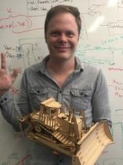
Dr Tyson Phillips
Director - Teaching and Learning & Senior Lecturer
School of Mechanical and Mining Engineering
Affiliate of Future Autonomous Systems and Technologies
Future Autonomous Systems and Technologies
+61 7 336 53587

Book Chapter
Bhandari, Vedant, Phillips, Tyson and McAree, Ross (2024). Novel approaches for point cloud analysis with evidential methods: a multifaceted approach to object pose estimation, point cloud odometry, and sensor registration. Point cloud generation and its applications. (pp. 1-23) edited by Cumhur Şahin. London, United Kingdom: IntechOpen. doi: 10.5772/intechopen.1004467
Journal Articles
Bhandari, Vedant, James, Jasmin, D’Adamo, Timothy, Phillips, Tyson and Ross McAree, P. (2025). Real-time dynamic terrain mapping for autonomous mining operations. IEEE Transactions on Field Robotics, 2, 437-464. doi: 10.1109/tfr.2025.3583973
Bhandari, Vedant, Phillips, Tyson Govan and McAree, Peter Ross (2024). Minimal configuration point cloud odometry and mapping. The International Journal of Robotics Research, 43 (11), 1831-1850. doi: 10.1177/02783649241235325
Bhandari, Vedant, James, Jasmin, Phillips, Tyson and McAree, P. Ross (2024). Probabilistic height grid terrain mapping for mining shovels using LiDAR. IFAC-PapersOnLine, 58 (22), 54-59. doi: 10.1016/j.ifacol.2024.09.290
Bhandari, Vedant, Phillips, Tyson Govan and McAree, Peter Ross (2023). Real-time 6-DOF pose estimation of known geometries in point cloud data. Sensors, 23 (6) 3085, 1-25. doi: 10.3390/s23063085
D’Adamo, Timothy, Phillips, Tyson and McAree, Peter (2022). LiDAR-stabilised GNSS-IMU platform pose tracking. Sensors, 22 (6) 2248, 2248. doi: 10.3390/s22062248
Phillips, Tyson, D’Adamo, Tim and McAree, Peter (2021). Maximum sum of evidence—an evidence-based solution to object pose estimation in point cloud data. Sensors, 21 (19) 6473, 6473. doi: 10.3390/s21196473
D’Adamo, Timothy Andrew, Phillips, Tyson Govan and McAree, Peter Ross (2018). Registration of three-dimensional scanning LiDAR sensors: an evaluation of model-based and model-free methods. Journal of Field Robotics, 35 (7), 1182-1200. doi: 10.1002/rob.21811
Phillips, T. G. and Mcaree, P. R. (2018). An evidence-based approach to object pose estimation from LiDAR measurements in challenging environments. Journal of Field Robotics, 35 (6), 921-936. doi: 10.1002/rob.21788
Phillips, Tyson Govan, Guenther, Nicky and Mcaree, Peter Ross (2017). When the dust settles: the four behaviors of LiDAR in the presence of fine airborne particulates. Journal of Field Robotics, 34 (5), 985-1009. doi: 10.1002/rob.21701
Phillips, T. G., Green, M. E. and McAree, P. R. (2016). Is it what I think it is? Is it where I think it is? Using point-clouds for diagnostic testing of a digging assembly's form and pose for an autonomous mining shovel. Journal of Field Robotics, 33 (7), 1013-1033. doi: 10.1002/rob.21643
Phillips, T. G., Green, M. E. and McAree, P. R. (2015). An Adaptive Structure Filter for Sensor Registration from Unstructured Terrain. Journal of Field Robotics, 32 (5), 748-774. doi: 10.1002/rob.21562
Conference Papers
Phillips, Tyson, Hahn, Martin and McAree, Ross (2013). An evaluation of ranging sensor performance for mining automation applications. IEEE/ASME International Conference on Advanced Intelligent Mechatronics: Mechatronics for Human Wellbeing, Wollongong, NSW, Australia, 9-12 July 2013. Piscataway, NJ, United States: IEEE. doi: 10.1109/AIM.2013.6584271
Phillips, Tyson, Hahn, Martin and McAree, Ross (2012). An evaluation of ranging sensor performance for mining automation applications. 2012 Australian Mining Technology Conference, Perth, WA, Australia, 8-10 October 2012. Brisbane, Qld., Australia: Colourwise Digital.
Preprint
Thesis
Phillips, Tyson (2016). Determining and verifying object pose from LiDAR measurements to support the perception needs of an autonomous excavator. PhD Thesis, School of Mechanical and Mining Engineering, The University of Queensland. doi: 10.14264/uql.2016.787
